edited tags
Link
benteh
  • 10.8k
  • 4
  • 44
  • 60
added 25 characters in body; edited title
Source Link
Yisela
  • 26.5k
  • 11
  • 74
  • 122

Mapping Software Recommendationsrecommendation: What program can I use to create maps like these?

I have tried to look online for an answer but I don't seem to be able to find what I am looking for. Here is my questions:

What is used to create maps like this:

http://www.nps.gov/arch/planyourvisit/upload/archmap.pdfenter image description here
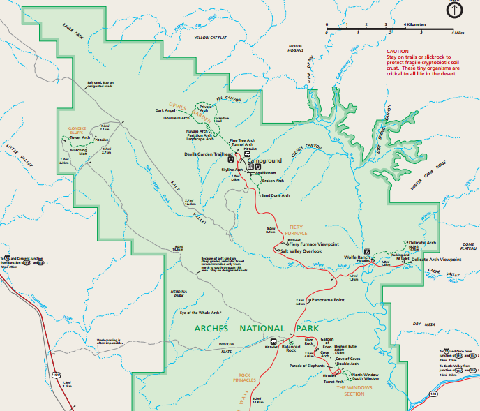
and like this:

http://www.transitchicago.com/assets/1/brochures/ctaSystemMapBrochure.pdf

My goal is to augment already existing map with a few extra elements. I checked out Edraw Max but it does not seem to be able to upload a customized background.

So basically it would be great if the software accepted a .pdf file like above (I think it is already in a vector form) and after minor change and editing, I would be able to generate a similar .pdf file

Any suggestions would be greatly appreciated.

Mapping Software Recommendations

I have tried to look online for an answer but I don't seem to be able to find what I am looking for. Here is my questions:

What is used to create maps like this:

http://www.nps.gov/arch/planyourvisit/upload/archmap.pdf

and like this:

http://www.transitchicago.com/assets/1/brochures/ctaSystemMapBrochure.pdf

My goal is to augment already existing map with a few extra elements. I checked out Edraw Max but it does not seem to be able to upload a customized background.

So basically it would be great if the software accepted a .pdf file like above (I think it is already in a vector form) and after minor change and editing, I would be able to generate a similar .pdf file

Any suggestions would be greatly appreciated.

Software recommendation: What program can I use to create maps like these?

I have tried to look online for an answer but I don't seem to be able to find what I am looking for. Here is my questions:

What is used to create maps like this:

enter image description here

and like this:

http://www.transitchicago.com/assets/1/brochures/ctaSystemMapBrochure.pdf

My goal is to augment already existing map with a few extra elements. I checked out Edraw Max but it does not seem to be able to upload a customized background.

So basically it would be great if the software accepted a .pdf file like above (I think it is already in a vector form) and after minor change and editing, I would be able to generate a similar .pdf file

Any suggestions would be greatly appreciated.

Source Link

Mapping Software Recommendations

I have tried to look online for an answer but I don't seem to be able to find what I am looking for. Here is my questions:

What is used to create maps like this:

http://www.nps.gov/arch/planyourvisit/upload/archmap.pdf

and like this:

http://www.transitchicago.com/assets/1/brochures/ctaSystemMapBrochure.pdf

My goal is to augment already existing map with a few extra elements. I checked out Edraw Max but it does not seem to be able to upload a customized background.

So basically it would be great if the software accepted a .pdf file like above (I think it is already in a vector form) and after minor change and editing, I would be able to generate a similar .pdf file

Any suggestions would be greatly appreciated.