0

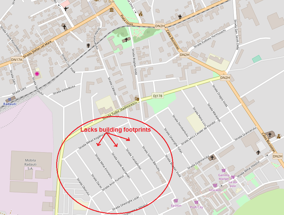
I would like to build a 3D miniature of a city, and I think the best way to do that is to import an image to Sketchup and then use the 3D tools provided by the software. It works like a charm if I import the maps from OpenStreetMap (as also recommended here), but there is a problem. The city I'm interested in has only some main buildings in the city center but lacks many of them in other important areas (see the picture below).

enter image description here

I've been trying to search for maps that would have all the buildings' footprints, but I fail to find one. I think the city is too unimportant to have such a complete map, so the only thing that comes to my mind is to find other artifices to do that. Google Maps sounds like an option, because it offers the satellite images of all the buildings but exporting the image as BMP would also include building shadows which would make it difficult to find the outline of the houses. But figuring out outlines would be very time-consuming and imprecise.

Can anyone help me to figure out what methods to use to extract such a complete map for getting all the buildings' footprints? I assume that I would have to do it with Google Maps Satellite View, but how can one remove the shadows and get the ground footprints/outlines?

2 Answers 2

1

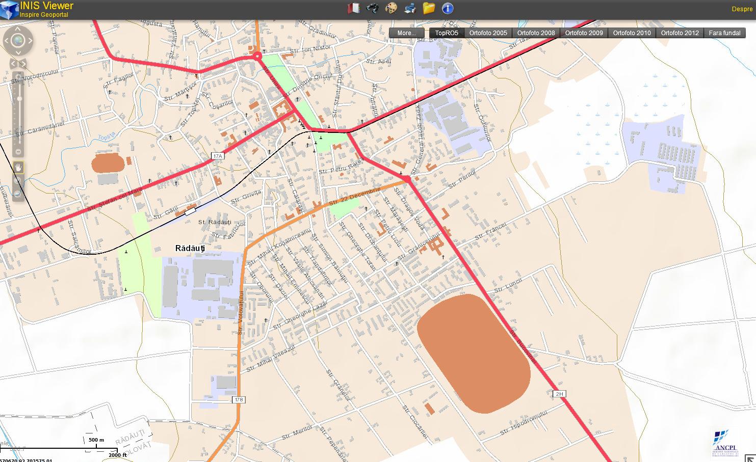
You didn't search hard enough. I found this in a few minutes. The link to the Romanian ANCPI portal is: http://geoportal.ancpi.ro/geoportal/viewer/index.html

enter image description here

9
  • ew - the page requires flash player...
    – Luciano
    Commented Apr 6, 2018 at 9:18
  • @Luciano Yes, sadly.
    – Billy Kerr
    Commented Apr 6, 2018 at 9:20
  • Thank you soooo much! Never, never knew about this. I googled a lot, believe me. I even tried to find it in some kind of AutoCAD database. But this is so helpful! Great! Thank you again Commented Apr 6, 2018 at 9:21
  • Now the challenge is to get a vectorial format out of that flash Commented Apr 6, 2018 at 9:22
  • @CuriosPaul - ANCPI seems to be the Romanian national mapping agnency, which is what I googled to find it, most countries have a similar service. Here in the UK ours is called Ordnance Survey.
    – Billy Kerr
    Commented Apr 6, 2018 at 9:23
1

Short answer: look for GIS databases for the given municipalities.

I use QGIS (Quantum GIS) which is open-source and freeware, and widely used in academia and research and some planning & architecture firms.

Most GIS databases will have building footprints as one of the vector layers you can download and use - these can be exported out as DXF, which SketchUp imports quite happily.

If you don't wish to go to that level of rigour, then import a HR Google Maps. Bing or Apple Maps view, apply as a texture to a plane, and start drawing forms on that plane, and extrude them out the correct height for rough massing.

1
  • 1
    Thank you! I will try to see how it goes with GIS Commented Apr 6, 2018 at 9:28

Your Answer

By clicking “Post Your Answer”, you agree to our terms of service and acknowledge you have read our privacy policy.

Not the answer you're looking for? Browse other questions tagged or ask your own question.